Establishing UplinkOperations
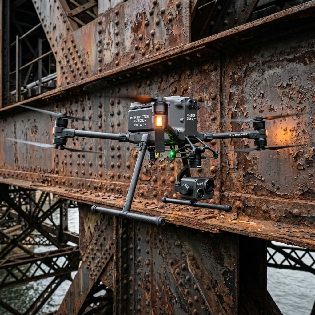
Greater London · 32 Boroughs · Commercial Aviation Standard
Commercial Drone Services
in London
Technical aerial inspection, thermal imaging, mapping and 3D site intelligence for London's commercial property and built environment.
CAA
Operational Authorisation
GVC
Qualified Remote Pilots
NATS
Airspace Coordination
£5M+
Aviation Liability
01 · Capital Operations
Specialist Aerial Intelligence
Across Greater London
Operating across London and Greater London, TFTS Drone provides facilities managers, commercial property consultancies, building surveyors, institutional asset owners, and construction contractors with high-resolution aerial inspection, radiometric thermography, high-level façade condition mapping, topographical photogrammetry, and TFTS 3D digital capture.
Commercial Focus: Designed specifically for corporate real estate portfolios, high-rise building envelopes, data centres, logistics parks, and active construction sites across the capital.
Commercial Property & FM
Proactive roof condition audits, gutter inspections, mechanical plant verification, and building envelope surveys for London managing agents and facilities directors.
Façade & Cladding Integrity
Close-range optical capture of high-rise elevations, curtain walling, louvres, and cladding panels to support EWS1 compliance, defect tracking, and warranty claims.
Thermal & Energy Auditing
Calibrated radiometric thermography for detecting sub-surface roof moisture ingress, thermal bridging, insulation degradation, and solar PV cell anomalies.
Construction & Development
Repeatable time-series aerial progress documentation, volumetric stockpile monitoring, and high-precision orthomosaics for major London development schemes.
02 · Commercial Capabilities
Core Drone Services
Available in London
Every service is delivered under standard operating procedures with calibrated enterprise UAV platforms, optical zoom payloads, and radiometric thermal sensors.
01 / Inspection
Drone Roof Surveys
Comprehensive commercial roof condition surveys across London. We inspect flat membranes, pitched roofing, gutters, parapets, rooflights, plant penetrations, and visible water pooling.
View Roof Surveys
02 / Building Audits
Commercial Drone Inspections
High-level structural and fabric condition assessments for commercial office blocks, retail parks, and industrial assets where traditional access is restricted or cost-prohibitive.
View Inspections
03 / Thermography
Thermal Drone Surveys
Radiometric aerial thermography for London commercial buildings. Rapidly diagnose sub-membrane moisture entrapment, insulation failures, and thermal bridging without destructive testing.
View Thermal Surveys
04 / Renewables
Solar PV Drone Inspections
IEC-compliant thermal and visual audits for rooftop commercial solar installations and institutional PV portfolios. Pinpoint diode faults, hotspot anomalies, and soiling losses.
View Solar Audits
05 / Elevational
Façade & Cladding Inspections
High-resolution optical inspections of vertical building elevations, cladding panels, curtain walling, and masonry across London's mid- and high-rise commercial structures.
View Façade Surveys
06 / Geospatial
Drone Surveying & Mapping
RTK-georeferenced 2D orthomosaics, digital terrain models (DTM), and topographical photogrammetry for London development sites, brownfield plots, and infrastructure corridors.
View Mapping Services
07 / Construction
Construction Progress Monitoring
Repeatable aerial time-series documentation for London contractors, fund monitors, and developers. Milestone tracking with consistent angles, GPS coordinate locking, and orthomosaic overlays.
View Construction Capture
08 / Spatial 3D
TFTS 3D Digital Capture
Interactive 3D Gaussian Splatting and high-fidelity digital twins for London commercial real estate, planning submissions, heritage conservation, and immersive stakeholder reviews.
Explore TFTS 3D
03 · Operational Rigour
Why London Requires
Technical Flight Planning
Commercial drone operations in London exist within some of the world's most densely populated and tightly managed airspace environments. Achieving safe, compliant, and actionable survey results requires structured technical mission planning around the physical site rather than simply arriving and launching a drone.
From Heathrow and London City Flight Restriction Zones (FRZ) to Central London restricted areas (EGR157 / EGR158), urban wind turbulence, and complex ground risk profiles, every flight is preceded by comprehensive desk and site-level risk assessments.
Our London Pre-Flight Protocol
- Airspace Clearance: Automated and manual review of NATS AIS, NOTAMs, CTR boundaries, and local heliport corridors.
- Ground Environment & Cordoning: Establishing dedicated takeoff/landing zones (TOAL) and cordon perimeters to manage public interface.
- Microclimate & Wind Canyoning: Analyzing urban downdrafts and eddy currents around tall commercial structures prior to launch.
- Privacy & Data Governance: Compliance with GDPR and CAA overflight guidelines regarding non-target third-party properties.
Constraint 01
Controlled Airspace
Coordination with London Air Traffic Control, NATS, and relevant airport safeguarding authorities where required.
Constraint 02
High-Density Urban Fabric
Meticulous line-of-sight maintenance and GPS multipath management amongst dense commercial and residential towers.
Constraint 03
Pedestrian & Traffic Density
Early morning or weekend deployment scheduling to minimise ground risk and avoid disruption to building occupants.
04 · Commercial Applications
Commercial Property
Use Cases in London
Application 01
Planned Maintenance (PPM)
Capture high-resolution baseline condition data across commercial roofs, gutters, and façades before annual capital maintenance budgets and repair contracts are committed.
Asset Managers & Managing Agents
Application 02
Reactive Defect Investigation
Rapidly obtain high-level visual and thermal evidence following reported roof leaks, storm damage, fallen masonry, or failing cladding panels across commercial estates.
Facilities & Operations Directors
Application 03
Acquisition Due Diligence & Dilapidations
Supplement commercial building surveyors and acquisition teams with uncompromised high-level optical evidence to support technical due diligence and lease-end negotiations.
Building Surveyors & Investors
Application 04
Portfolio-Wide Condition Auditing
Apply uniform, standardized inspection workflows across distributed commercial and retail property portfolios in London, delivering comparable reporting for asset scoring.
Property REITs & Fund Managers
Application 05
Construction Verification & Monitoring
Maintain an objective, timestamped photographic record of development progress, structural steelwork, concrete pours, and building envelope installation for project funders.
Main Contractors & Developers
Application 06
Difficult-Access Inspection
Safely inspect complex high-level building elements where scaffolding, MEWPs, or rope access are impractical, overly disruptive, or financially disproportionate for initial scoping.
Consultants & Estates Teams
05 · Technical Scope
Building Elements
Captured by Drone
Scope is strictly defined around the objectives of each commercial survey. Our enterprise optical zoom and radiometric payloads allow detailed evaluation of critical external components.
Horizontal Envelope
- Flat single-ply & bituminous membranes
- Profiled standing seam metal roofing
- Parapet walls, copings & capping stones
- Box gutters, valleys & rainwater outlets
- Rooflights, barrel vaults & glazing bars
- HVAC plant, ductwork & pipe penetrations
- Rooftop solar PV strings & inverters
Vertical Façade Envelope
- Aluminium composite & rainscreen cladding
- Curtain walling & structural glazing seals
- Portland stone & terracotta architectural masonry
- Brickwork spalling, pointing & expansion joints
- High-level louvres, vents & brise soleil
- Window reveals, flashing details & sills
- External risers, flues & fire escapes
Structural & Site Assets
- Structural steel connections & purlins
- Bridge bearings, abutments & deck undersides
- Telecommunications masts & towers
- Hardstanding, car parks & yard logistics areas
- Boundary walls, fencing & perimeter security
- Surface water drainage runs & outfalls
- Brownfield development site topography
06 · Tangible Outputs
Structured Technical
Deliverables
Deliverables are defined around the purpose of the survey. We do not provide raw, unorganized imagery dumps. Data is processed, structured, and presented to integrate seamlessly with facilities management systems, CAFM workflows, CAD software, and RICS technical condition reports.
Fast turnaround available for urgent leak diagnosis and insurance incident evidence across London.
High-Res Inspection Pack
Georeferenced 48MP+ photographic library with optical zoom close-ups of all identified defects and asset components.
Annotated Condition Reports
Defect schedules categorized by severity rating, location markup, and photographic evidence for contractor scoping.
Radiometric Thermal Datasets
Calibrated temperature-mapped thermal imagery with spot temperature measurements and moisture ingress heatmaps.
Orthomosaics & CAD Maps
Millimetre-accurate 2D stitched orthomosaics delivered in GeoTIFF, DXF, and high-resolution PDF formats.
3D Point Clouds & Mesh
Photogrammetric LAS point clouds and textured 3D OBJ meshes ready for integration into BIM and Revit workflows.
TFTS 3D Interactive Viewer
Browser-based interactive 3D digital model for collaborative site exploration without specialist desktop software.
07 · Spatial Innovation
TFTS 3D
Interactive Site Intelligence
TFTS 3D represents our premium capability for generating high-fidelity interactive 3D representations of real-world London buildings, commercial developments, and complex assets from aerial and terrestrial capture data.
Unlike traditional photogrammetry which often struggles with complex glass, metallic surfaces, and fine geometric details, TFTS 3D utilizes advanced spatial neural radiance representations to produce photorealistic interactive digital environments that can be explored directly in any web browser.
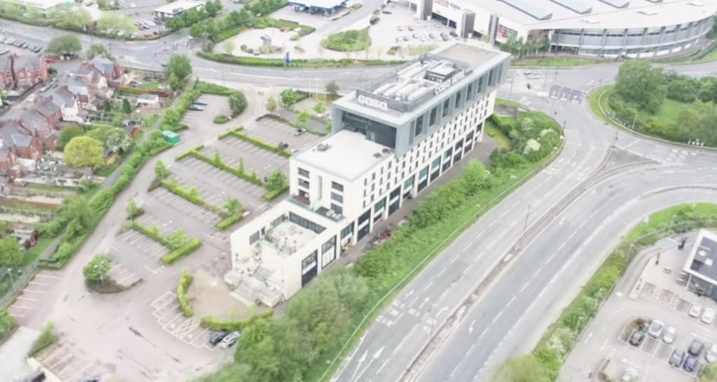
Proprietary Spatial CaptureInteractive 3D Digital Model
Launch Model08 · Industry Specialisms
London Sectors We Support
Commercial Property
Landlords, managing agents, and REITs managing central London office towers, business parks, and retail centres.
Facilities Management
Total and hard FM service providers requiring rapid building envelope diagnostics and planned maintenance data.
Construction & Development
Tier 1 and Tier 2 contractors managing active London urban development schemes and high-rise envelope installations.
Building Surveyors & Consultants
RICS chartered surveyors, structural engineers, and façade consultants seeking uncompromised close-range aerial data.
Infrastructure & Transport
Rail interchanges, transport corridors, utility compounds, and river crossing infrastructure across Greater London.
Solar & Renewable Energy
Commercial solar asset operators, local authorities, and corporate clients with rooftop PV installations.
09 · Geographic Scope
Operating Across
All 32 London Boroughs
TFTS Drone provides commercial drone survey coverage across Central London and the wider Greater London area. Our mobile remote pilot crews are equipped for prompt deployment with standardized flight planning and safety documentation.
Unified Reporting Standard
Whether surveying a single commercial tower in the City or fifty retail units spread from Hillingdon to Havering, data is delivered in a uniform format ready for portfolio analysis.
Central & City
City of London, Westminster, Camden, Islington, Southwark, Lambeth, Kensington & Chelsea.
East & Docklands
Tower Hamlets, Canary Wharf, Newham, Hackney, Greenwich, Barking & Dagenham, Havering.
West & M4 Corridor
Hammersmith & Fulham, Ealing, Hounslow, Hillingdon, Brent, Harrow, Richmond upon Thames.
North & South Outer
Barnet, Enfield, Haringey, Waltham Forest, Wandsworth, Merton, Sutton, Croydon, Bromley, Kingston, Bexley, Lewisham.
10 · Frequently Asked Questions
Commercial Drone Services
London FAQs
Yes. Drones are routinely deployed across London to inspect commercial buildings, office towers, logistics assets, retail centres, and infrastructure. They provide high-resolution visual and thermal evidence of roof coverings, cladding systems, parapets, and plant equipment without the immediate requirement for costly and disruptive scaffolding, cherry pickers, or rope access.
Yes. We operate across Central London, including the City of London, Westminster, and the South Bank. Central London involves complex airspace including NATS-controlled airspace and specific restricted areas (such as EGR157/EGR158). We manage all necessary airspace notifications, flight planning, and site-specific risk assessments (RAMS) to ensure fully compliant operations.
To plan a London drone survey, we require the site address and postcode, an outline of the asset or areas requiring inspection (e.g. whole roof, specific elevations, solar array), any known site access or rooftop constraints, and the target deliverable format. Our operations team conducts a preliminary desk-based airspace and hazard assessment before confirming operational feasibility.
A drone survey significantly reduces the need for access equipment during the initial inspection, condition assessment, and defect identification phase. It provides surveyors and asset managers with clear visual evidence to diagnose problems and target physical repairs accurately. Intrusive physical testing or remediation works may still require physical access, but the scope and duration can be greatly reduced.
Yes. We utilise high-resolution radiometric thermal cameras to conduct aerial building envelope thermography, flat roof moisture ingress detection, and commercial rooftop solar PV inspections across London. Thermal surveys are planned during specific temperature and weather windows to deliver accurate, quantifiable delta-T measurements.
Yes. Our drones are equipped with high-resolution optical zoom sensors capable of capturing detailed imagery of cladding panels, curtain walling, mastic seals, louvres, and masonry joints from a safe standoff distance. This visual data supports EWS1 assessments, routine condition monitoring, and post-storm defect reporting.
Deliverables are defined around the purpose of the survey. Standard outputs include high-resolution georeferenced inspection imagery, structured photographic defect schedules, radiometric thermal datasets, 2D orthomosaics, 3D photogrammetric point clouds, and interactive TFTS 3D digital site models.
Yes. We regularly deliver structured multi-site survey programmes for commercial managing agents, REITs, and corporate estate directors with distributed London portfolios. We coordinate scheduling geographically to maximise operational efficiency and supply uniform, standardized reporting across all assets.
Commission a Commercial
Drone Survey in London
Tell us about your asset, location, and required deliverables. Our operations team will perform a preliminary airspace and feasibility review and provide a structured commercial proposal.