Establishing UplinkOperations
Spatial Intelligence
TFTS 3D
INTERACTIVE 3D MODELLING
& DIGITAL SITE CAPTURE
High-fidelity 3D models created from aerial and ground-based survey data. Explore buildings, sites and assets in an immersive interactive 3D environment.
Immersive viewingHigh-fidelity captureStakeholder presentationDigital twin records
01 · Interactive 3D
EXPLORE
TFTS 3D IN ACTION
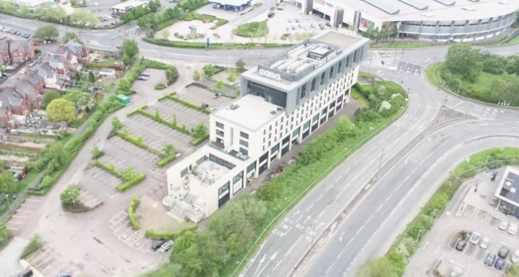
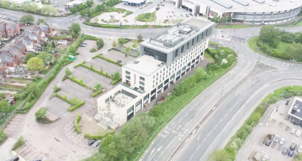
Interact with a representative TFTS 3D digital site capture. Drag to orbit, scroll to zoom, and right-click drag to pan through the full spatial environment.
Spatial data ready
Scroll to activate 3D viewer
Interactive TFTS 3D model captured by TFTS Drone. Powered by advanced TFTS 3D modelling and photogrammetric capture technology. Best experienced on a desktop device with WebGL 2 support.
TFTS 3D Visualisation·Desktop with WebGL 2 recommended
02 · Capability
WHAT IS
TFTS 3D?
TFTS 3D is an immersive digital capture service that reconstructs buildings, infrastructure and land as interactive 3D spatial models. Rather than reviewing isolated photos or video, teams can navigate and inspect every facet of a site in full spatial context.
Powered by advanced TFTS 3D modelling and precision photogrammetric processing, TFTS 3D delivers photorealistic visual fidelity that traditional polygon meshes cannot replicate.
Commercial Value Drivers:
- Immersive stakeholder site presentations
- Property and development marketing
- Construction progress baseline records
- Heritage and conservation documentation
- Remote asset inspection and briefing
- Access-restricted location scouting
- Planning and public consultation
- Digital twin visual integration
03 · Applications
WHERE TFTS 3D
DELIVERS ADVANTAGE
Property & Development
Allow investors, buyers and planning stakeholders to explore developments through photorealistic spatial context.
Construction Progress
Capture project milestones as navigable 3D records for stakeholder reporting and chronological comparison.
Heritage & Conservation
Preserve historic architecture, estates and sensitive structures with high-fidelity visual documentation.
Public Consultation
Help non-technical stakeholders understand the scale, appearance and landscape integration of proposed schemes.
Facilities Management
Create complete visual records of complex roofs, plant areas, façades and difficult-to-access structures.
Insurance & Dilapidations
Establish indisputable, navigable 3D baseline records of building condition and structural context.
Film & Creative Scouting
Enable remote location assessment with true spatial depth and accurate lighting reproduction.
Estates & Infrastructure
Maintain comprehensive interactive models for asset management, masterplanning and logistics.
04 · FAQ
FREQUENTLY ASKED
QUESTIONS
TFTS 3D is our proprietary interactive 3D modelling and digital site capture service. It creates photorealistic 3D representations of real-world environments, allowing stakeholders to explore assets from any angle and viewpoint rather than relying on flat photography or fixed video.
TFTS 3D is produced from precision drone flight paths combined with ground-level capture for complete spatial coverage. Captured imagery is processed using advanced TFTS 3D modelling and photogrammetric algorithms to reconstruct high-fidelity spatial models.
TFTS 3D is primarily an immersive visual intelligence asset. For measurement-critical engineering or boundary verification, we combine TFTS 3D capture with RTK GNSS, ground control points (GCPs), LiDAR and survey-grade photogrammetry workflows.
It is ideal for stakeholder presentations, development marketing, construction progress documentation, heritage preservation, remote site induction, insurance baseline records and digital twin integration.
Yes. We deliver web-optimised 3D models ready for integration into client portals, investor presentations or project websites, complete with interactive orbit, zoom and pan controls.
Traditional photogrammetry meshes often exhibit texture distortion or simplified geometry on complex surfaces (like foliage, glass or railings). TFTS 3D delivers significantly higher visual fidelity and realistic lighting response from any viewing perspective.
Ready to Visualise Your Site?COMMISSION A
COMMISSION A
TFTS 3D SURVEY
Speak with our aerial survey specialists to arrange high-fidelity 3D capture for your property, construction project or infrastructure asset.